

Haapsalu Veskiviigi
Haapsalu, Lääne County, Estonia
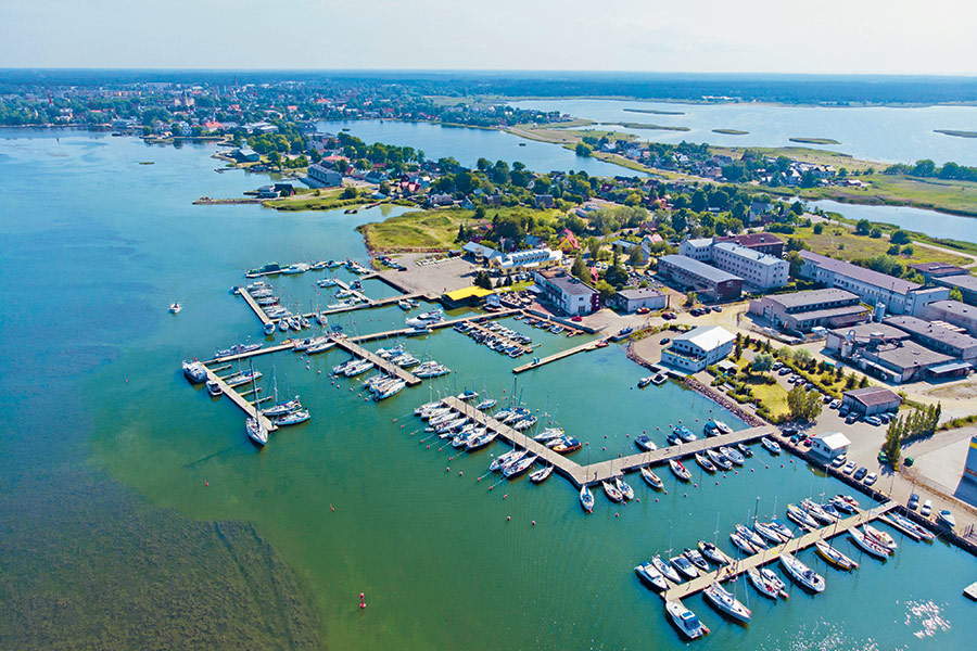
Harbour overview
N approach: follow Paralepa leading lights 152.7°–332.7° (Q W – Iso W 4 s) to Kajakarahu (2) (58°57.363’ N; 023°27.769’ E), then continue along 94.2°–274.2° (Q R – Iso R 3 s) and follow the channel into the bay. S approach: Rohuküla leading line 90.1°–270.1° (Q W – Oc. W 3 s), follow the cardinal buoys until Pinukse W cardinal (Q(9) W15 s). Then head east, until Kajakarahu (2), and follow the channel in. Exposed to E, NE winds, bay is shallow and choppy in W winds. All three (Veskiviigi, Grand Holm and Westmeri) Haapsalu marinas are close to each other.
Depth: 2.5 meters
Max LOA: 24.0 meters
Max Width: 6.0 meters
Number of Berths: 62
Services
- Saun
- Fuel for boats
- Fresh Water
- Maintenance
- Waste Disposal
- Slipway
- Electric Hookup
- Wi-Fi Access
- Marina office
- WC
- Shower
- Washing Machine
- Credit Card Payment
Depth Map
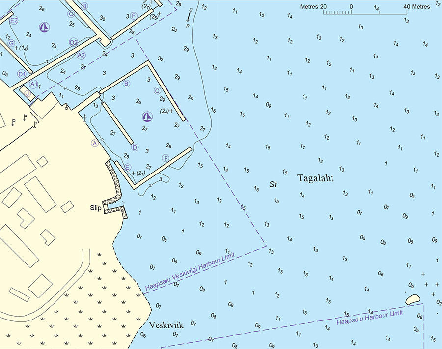
* Depths and heights measures in metres, in reference to mean sea level (BHS-77)
Haapsalu Veskiviigi
Haapsalu, Lääne County, Estonia
-
[javascript protected email address]
-
Holmi 14, Haapsalu, Lääne County, Estonia 58°57'30"N, 23°31'34"E